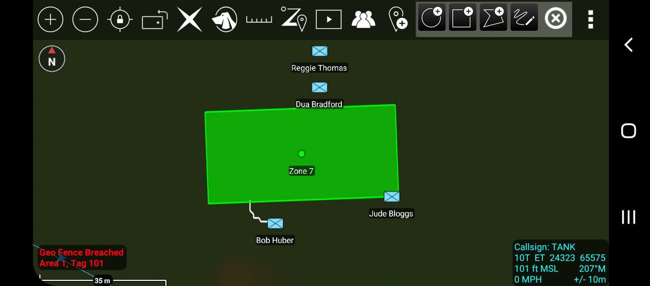
FIREFLY incorporates location accountability, long-range communication, and real-time analytics to increase operational accountability and situational awareness across wildland firegrounds.
FIREFLY keeps multiple wildland firefighter teams informed, protected, and connected across large, hazardous, GPS-denied areas.
FIREFLY capabilities are packaged in FIREFLY Device Kits and FIREFLY Platform subscription plans.

Join the Namatad platform update list
Get release updates as FIREFLY evolves from the original accountability system into a deployment-integrated incident data platform.
Start with the software-only base package: the firefighter app and FIREFLY platform. Add CANAIRY or FIREFLY tags later when your department needs exposure monitoring or finer location accountability.
info@namatad.com